Kasetsart University Holds Flood Forum with Bangkok, South Experts
Kasetsart University held a seminar on flood management, bringing together experts from Bangkok and southern Thailand to share lessons and discuss preparedness. Participants highlighted the need for coordinated water‑management strategies, real‑time radar rainfall monitoring, and community‑based sponge‑city measures. The event underscored that state agencies and local communities must work together to reduce flood risks.
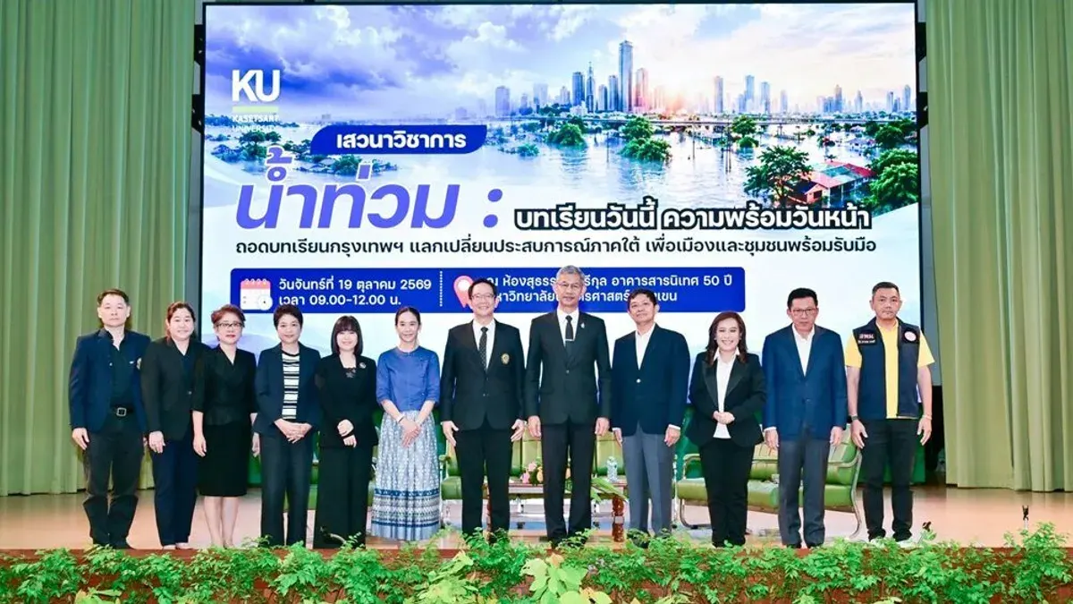
At Kasetsart University’s Bang Khen campus, President Assoc. Prof. Dr. Kongsak Teangtham opened the academic seminar "Flood: Lessons Today, Preparedness Tomorrow." The panel included Assoc. Prof. Dr. Bancha Khwan‑yuen from the Irrigation Engineering Department (Kasetsart Kamphaeng Saen), Assoc. Prof. Dr. Sitangsuth Philaillo and Assoc. Prof. Dr. Phanphen Phuttaraksa Maopeam from the Water Resources Engineering Department, Assoc. Prof. Dr. Sani Limthongskul of the Landscape Architecture Faculty, and Yala City Mayor Phongsak Yingchonmjaroen. The session was moderated by Khun Bussarin Yingkiattikul and a Thai PBS news presenter and ran for three hours.
Kongsak said he was pleased to host an event that showcases the university’s academic strength and its ability to help the nation, noting that the seminar brought together experts to exchange knowledge on flood and environmental issues that affect the economy and society. He emphasized Kasetsart’s role in pooling ideas and experience to forecast future challenges.
Phanphen explained that flood problems start with rainfall, so it is essential to know where, how long, and how intensely it rains. She noted that rainfall‑measuring stations of the Ministry of Interior and the Bangkok Metropolitan Administration must cooperate to develop water‑management and disaster plans. Radar‑based rain measurement, used in Thailand for about fifty years since World War II, provides high accuracy for short‑term forecasts (two to three hours) but cannot predict long‑term events. The system has been tested in several provinces; for example, in Rayong, rising water levels detected by the Radar4flood app allow authorities to prepare up to twelve hours in advance and to issue timely warnings that let residents move belongings to higher ground.
She added that the Tambon Thap Ma municipality in Rayong has used the research data to improve its warning system, enabling it to relocate goods safely and to turn the findings into policy that can be replicated in other provinces. The Office of National Water Resources has recognized the app’s value, although the underlying research project remains limited by the data currently available, and the information gathered has not been drawn from the Meteorological Department.